
The stairs are located at the top of Berendo Street, on Cromwell, about a block north of Los Feliz Blvd, just west of Vermont. There's a lovely little entrance, which leads to a somewhat steep set of stairs. There are about 100 stairs to climb up before you come to a rest point, which has two semi-circular stone benches on each side of the path. Above the rest point, there are about 70 more steps until you reach the street.


Once you arrive at the top of the staircase, you can go to your right and walk up the street and around the bend to locate another staircase, which is next to a garage of a yellowish house. That staircase has about 70 steps, which take you up between two homes and veers off to the left. It comes out on Glencairn, at the end of a cul-de-sac.


Once on the cul-de-sac, you turn right and follow the street out to a fork/t-junction in the road. You follow the fork to the left (I think it's called Catalina) and continue on up the streets. You'll reach another fork, where Catalina becomes Glendower (the signs are a bit confusing), and you'll keep to the right. Continue on up the hill...you'll reach another bend in the road eventually, where there is another set of stairs going down (marked "public walk")--you can use those as a short cut back down to the Berendo Staircase, which I'll explain later.
Anyway, continuing on up the street, you will come to another fork in the road. To the left is Glendower Road, which is a "No Outlet" street. To the right is Glendower Avenue. You'll want to go to the left. You'll follow the street a short way until it dead ends.

To the left, you will find a small gate over a single lane paved road (next to a house). You can enter Griffith Park from this gate. There is a door on the left of it, which is supposed to be locked at sundown**. **(update: This gate IS locked at sundown--be sure to plan your hike accordingly, or you'll be forced to climb the fence and jump over, which can be done--because I had to do it--but it's not exactly fun!)
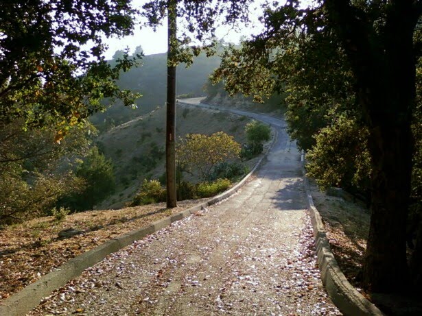
The single paved road snakes up the hill, leading to a network of other paths, one of which is a dirt path that veers to the left, up the hill. Follow that path, which will lead you to a trio of paths under the Observatory. If you take the path to the right, you will end up walking out right next to the Observatory!


This is a beautiful and unusual walk, as it incorporates these neat, beautiful (and in some cases, old) staircases...quiet, curvy roads in the hills, with beautiful homes everywhere...and quiet paths inside Griffith Park. The scenery is lovely, it's a mostly quiet trip (more folks around the Observatory), and it's almost entirely uphill from the time you start at the base of the Berendo Staircase, up to the Observatory. This is also a walk/hike that you can add or subtract from, depending on how active/energetic you feel.
The staircase that I mentioned earlier? The shortcut? That staircase, if you take it down, will lead to another staircase on a cul-de-sac. Take that second one and you'll find yourself on the same street where the Berendo Staircase ends up on...once you've come down the second staircase, you go to the right and follow the street down to the Berendo Staircase, which will be on your left hand side.

You can also add more on to your hike once you are in Griffith, either by exploring the other paths below the Observatory (which I haven't done), or continuing through the parking lot once you come out of the path at the top and moving into the network of paths behind the Observatory.
I believe that the route that I took was about 2 miles round trip--having a hard time figuring it out from my map, but that looks to be close. Add in around 250 stairs (climbing upward), give or take, too. Makes for a shorter trip, but has the potential for a good little workout! My legs are definitely sore!

Great post Danielle! I used GoogleMaps set to satellite to follow along. You may want to buy an app (or see if there is a free one) for your phone. Jack has one that tracks us as we hike or bike and can give a much more accurate distance traveled. I think it uses the GPS in the phone to do so. Pretty cool. xoxoxo
ReplyDelete